Image 1 of 5
 Image 2 of 5
 Image 3 of 5
 Image 4 of 5
 Image 5 of 5


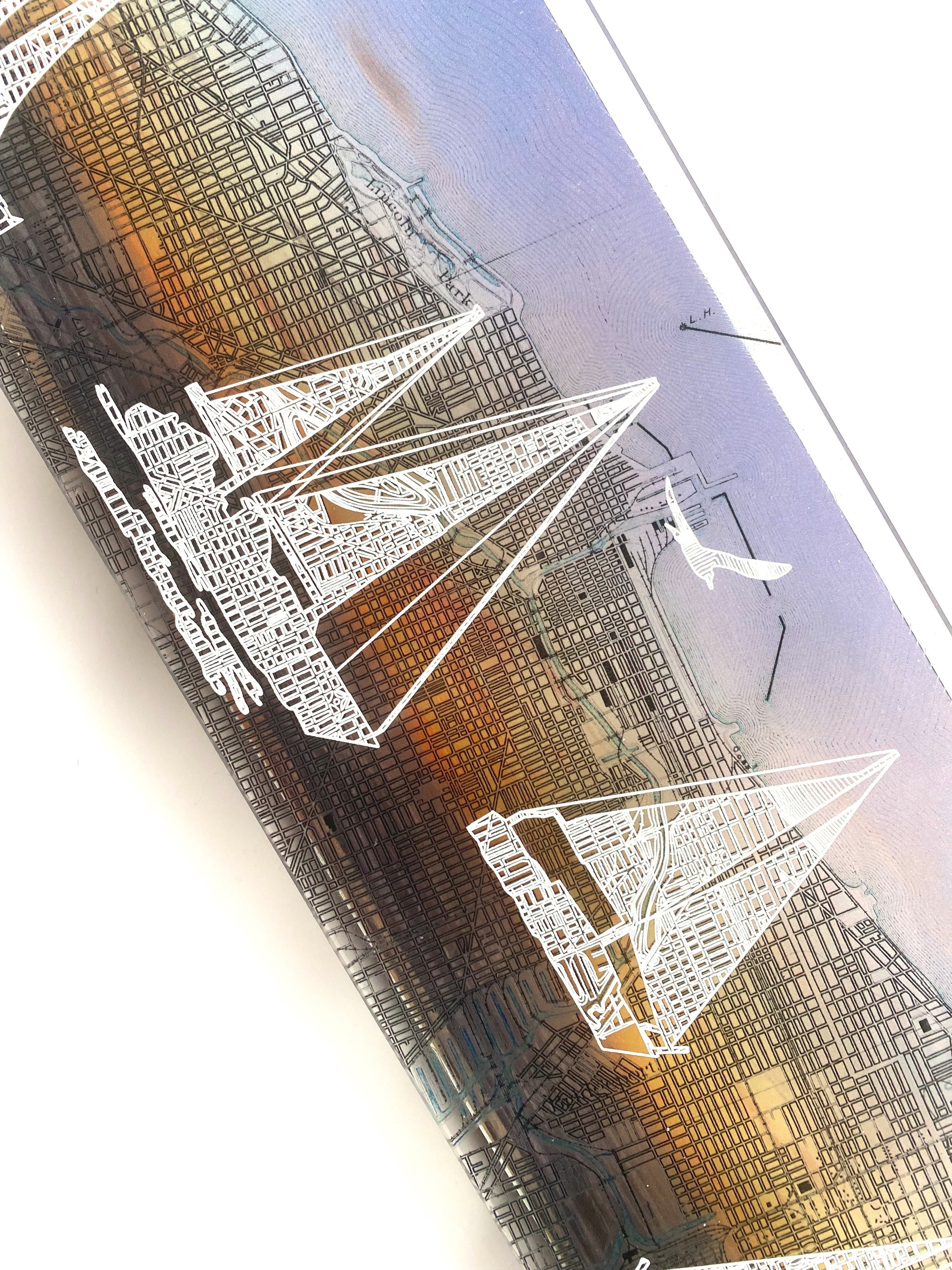
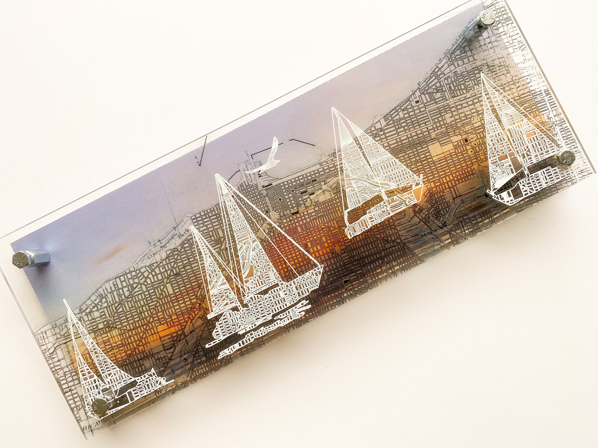
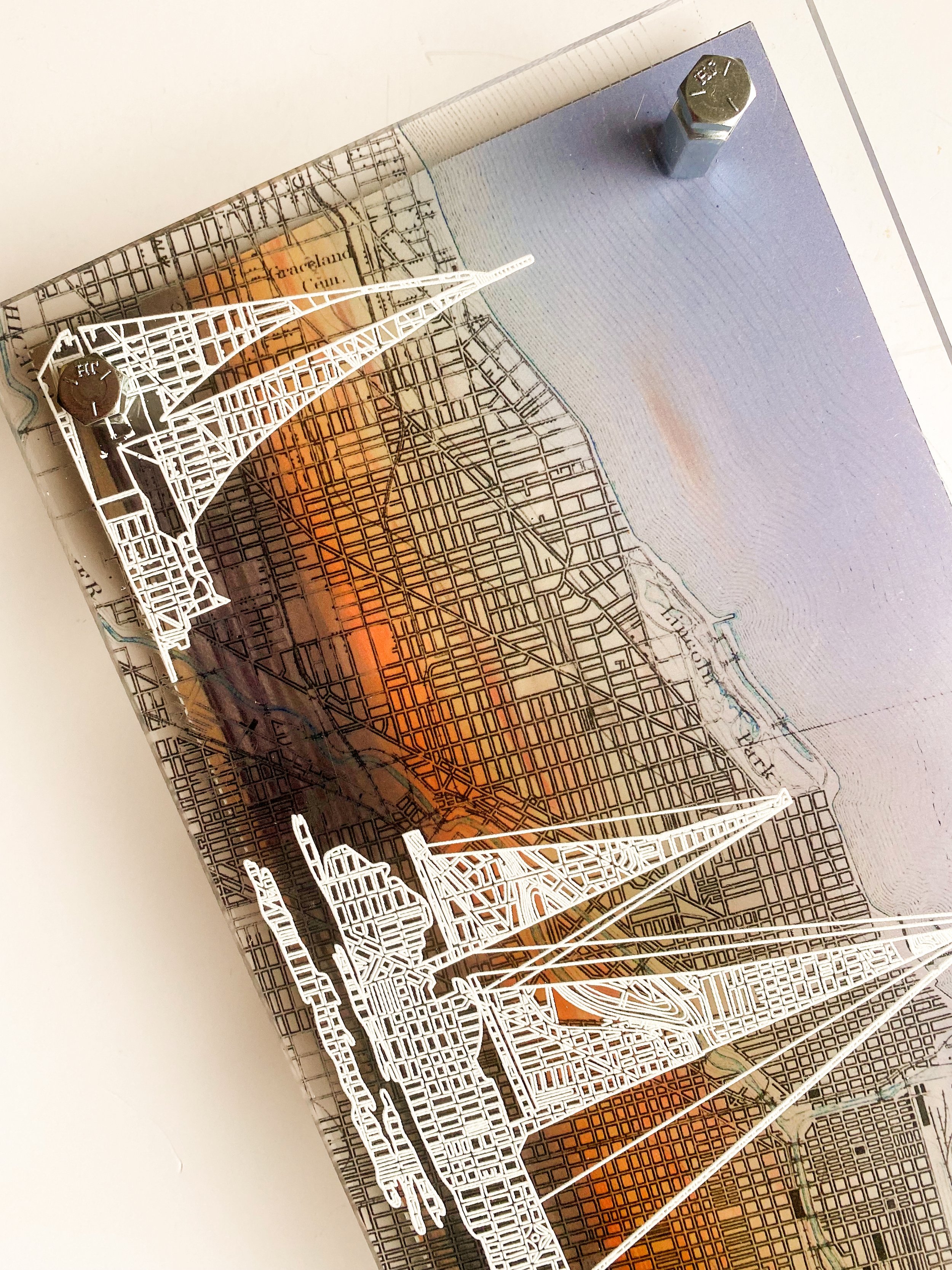
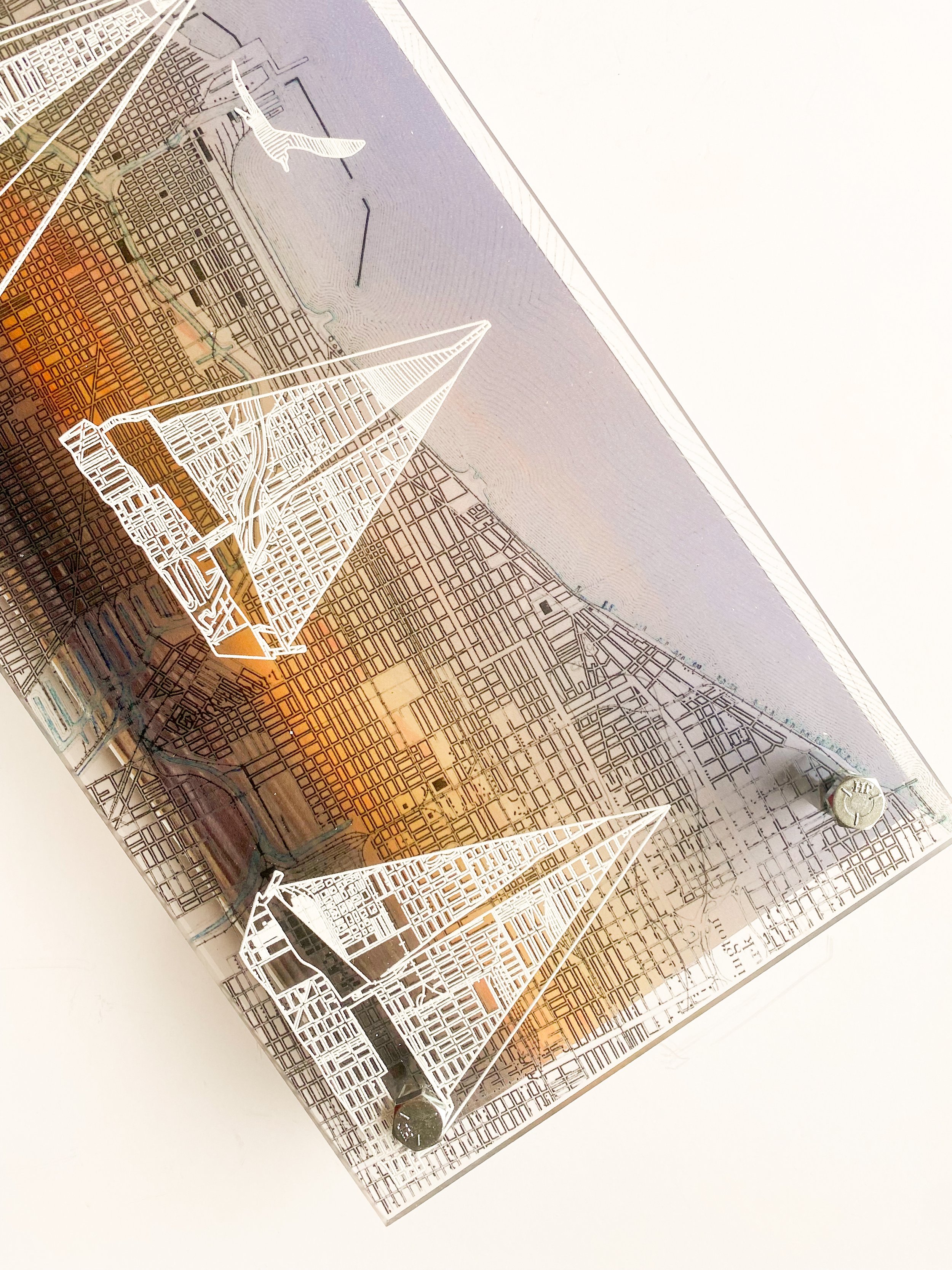
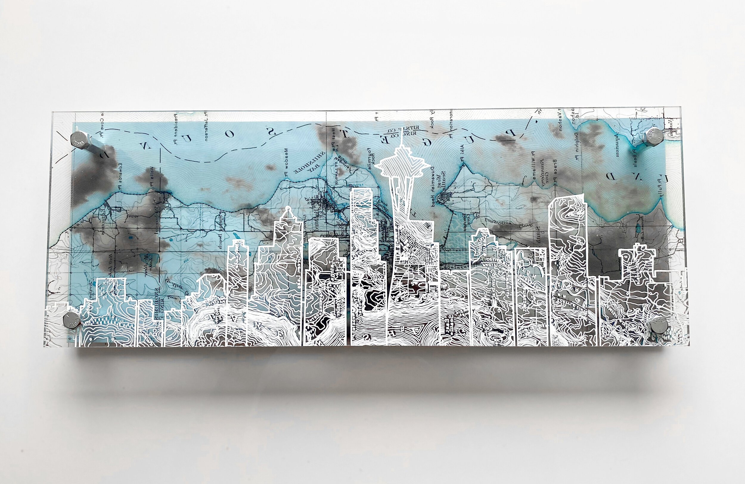
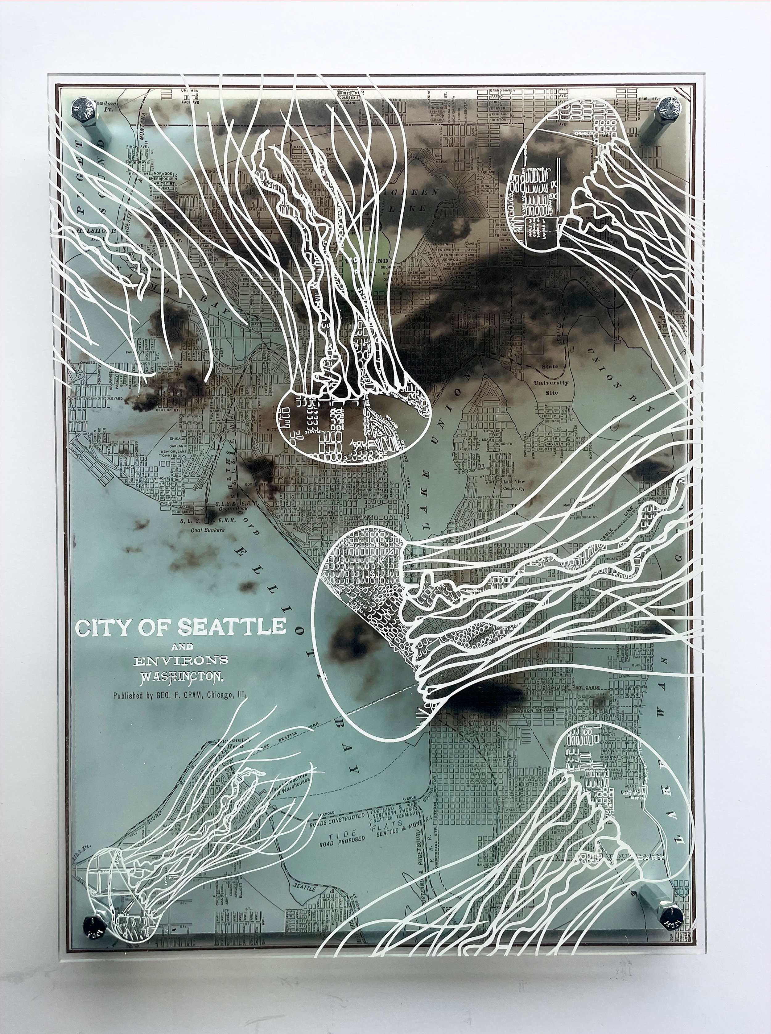
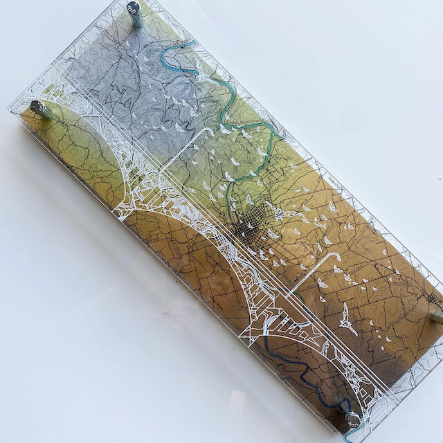
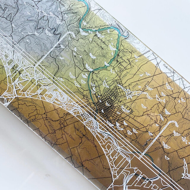
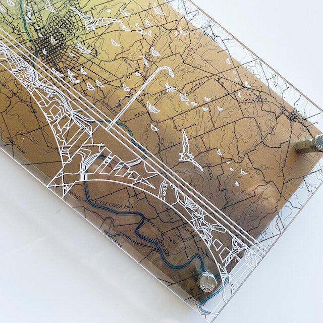
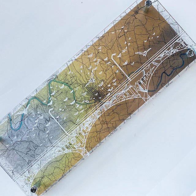
About my work:
Maps are designed on clear plexiglass - I trace the map lines within the silhouette in white ink, creating original patterns from the topography or city block lines. Each map & illustration is backed with an original photograph I took on location. The unframed, dimensional nature of my work showcases the map, illustration and photographs in a single, contemporary design.
All maps are based on GIS, Forest Service Maps and historical files.
Size 6” x 16”
Weight <1lbs
Hangs on Nail or Small Hook
Uv Rated, Water and Sunlight Proof.
Interested in a custom piece? Interested in a custom design- fill out my commission request form or shoot me an email, Hello@modernterrain.com
Octopus Photo Shows Layers Between the Map and Background Photography - the unframed frame of Modern Terrain.